|
|
|
Somme... The Battle of the Somme was fought by the armies of British Allies and the French against Germany. It took place between
1st July - 18th November 1916 around the River Somme area of France. This was one of the most embattled encounters
of the Great War with over 1,000,000 men wounded or killed. The first day of the battle (1st July 1916) saw the British alone
with 20,000 killed and 40,000 injured. Germany suffered 650,000 casualties during this battle which added to their significant
losses at Verdun during 1916. Despite these levels, the battle outcome was technically somewhat stalemate,
however, this battle was important to ensure:
The Somme also saw
the birth of modern warfare with the introduction of air support and tanks to the battlefield. When thinking
of the Somme, the picture conjured up in people’s minds is lots of mud. This was certainly the case, the torrential
rain of October 1916 made sure of this in a region that appears to hold the wet at the best of times. Nowadays
there are numerous CWGC cemeteries and memorials serving to preserve their memory and to ensure that what happened in
this rolling region of France is never ever forgotten. ......... o O o ......... If you need
Military Bands or Assistance with Honouring Veterans - Please contact your local Royal British Legion. If sadly this is for a Military Funeral or Honouring Veterans at their Funeral, the best contact points are here. The Commonwealth War Graves Commission has the responsibility to ensure that 1.7 million people who died in the two world wars will never be forgotten. They care
for cemeteries and memorials at 23,000 locations, in 153 countries. The CWGC values and aims, laid out in 1917, are as relevant
now as they were over a 100 years ago.... ......... o O o ......... We have added a number
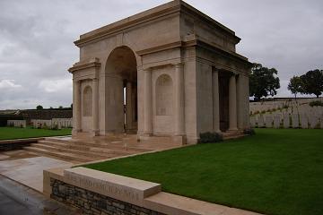
of further pages and Picture Galleries to our website for you of The National Memorial Arboretum, the Ypres Salient, Flanders & The Menin Gate, Nord Pas de Calais, Somme, Vimy Ridge, Verdun and World War 1 Main Page and seven underpinning pages. ......... o O o ......... The images below are: Picture 1 {0147} - The Memorial Gateway to the Fifth Army Missing at Pozieres Cemetery on which there are 14,690
names recorded of men who died on the Somme. Located just Southwest of the village of Pozieres 6km Northeast of Albert.
The 1st Australian and 48th (South Midland) Division captured Pozieres on 24 July 1916. It was lost again during the
great German advance on 24 -25 March 1918, and recaptured by the 17th Division on 24th August 1918. Most largely represented
on the memorial are The Rifle Brigade, The Durham Light Infantry, The Machine Gun Corps, The Manchester Regiment, and the
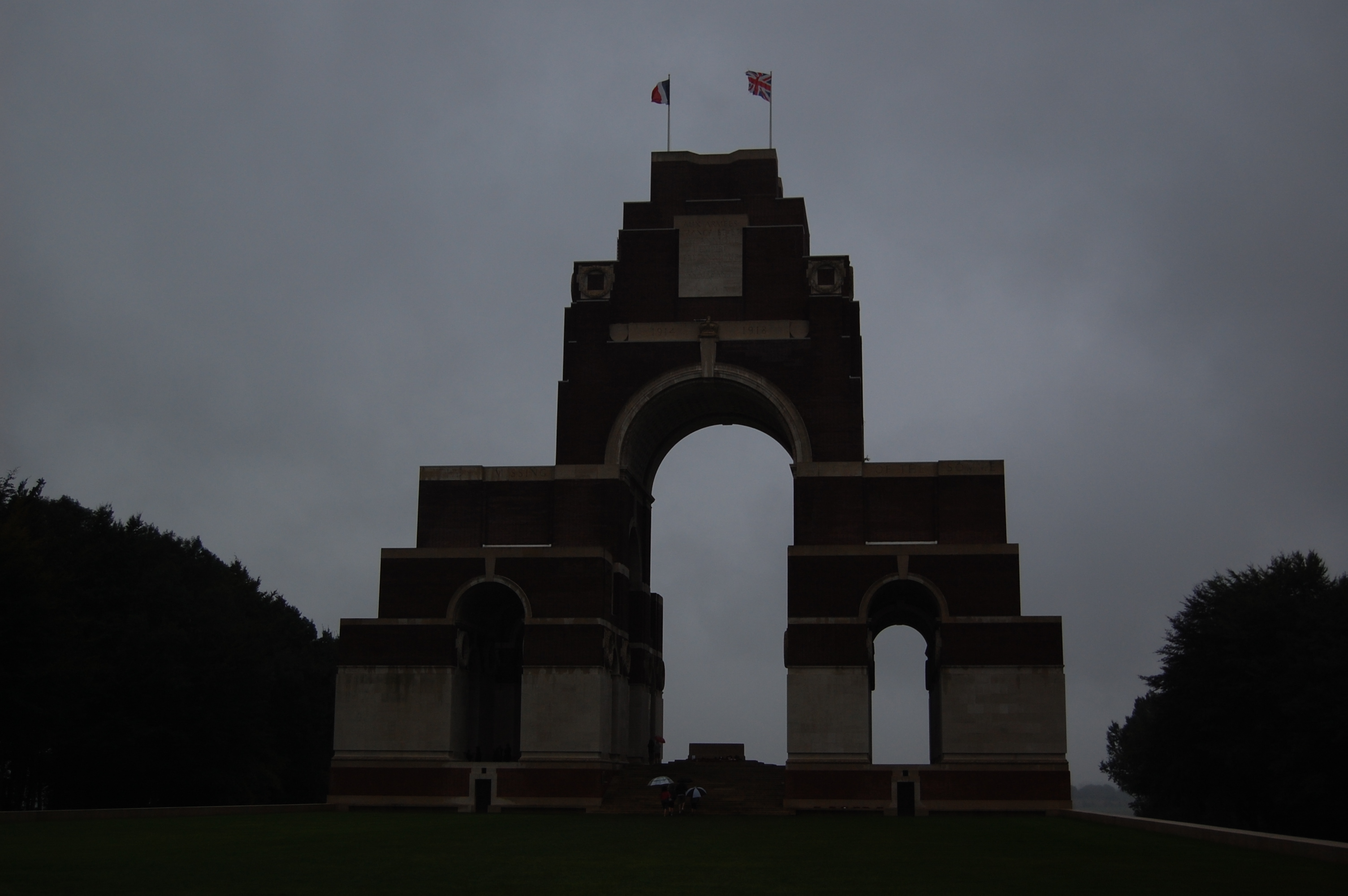
Royal Horse and Royal Field Artillery. Picture 2 {0151} - Thiepval Memorial to 73,412 men who have no
known grave and who died in 1916 and 1917. The memorial was designed by Sir Edwin Lutyens and built between 1928 and
1932. It was unveiled on 1st August 1932 by The Prince of Wales in the presence of The President of France. The hamlet of
Thiepval was a German fortress both above and below the ground and was a vital position for the British to take. It was captured
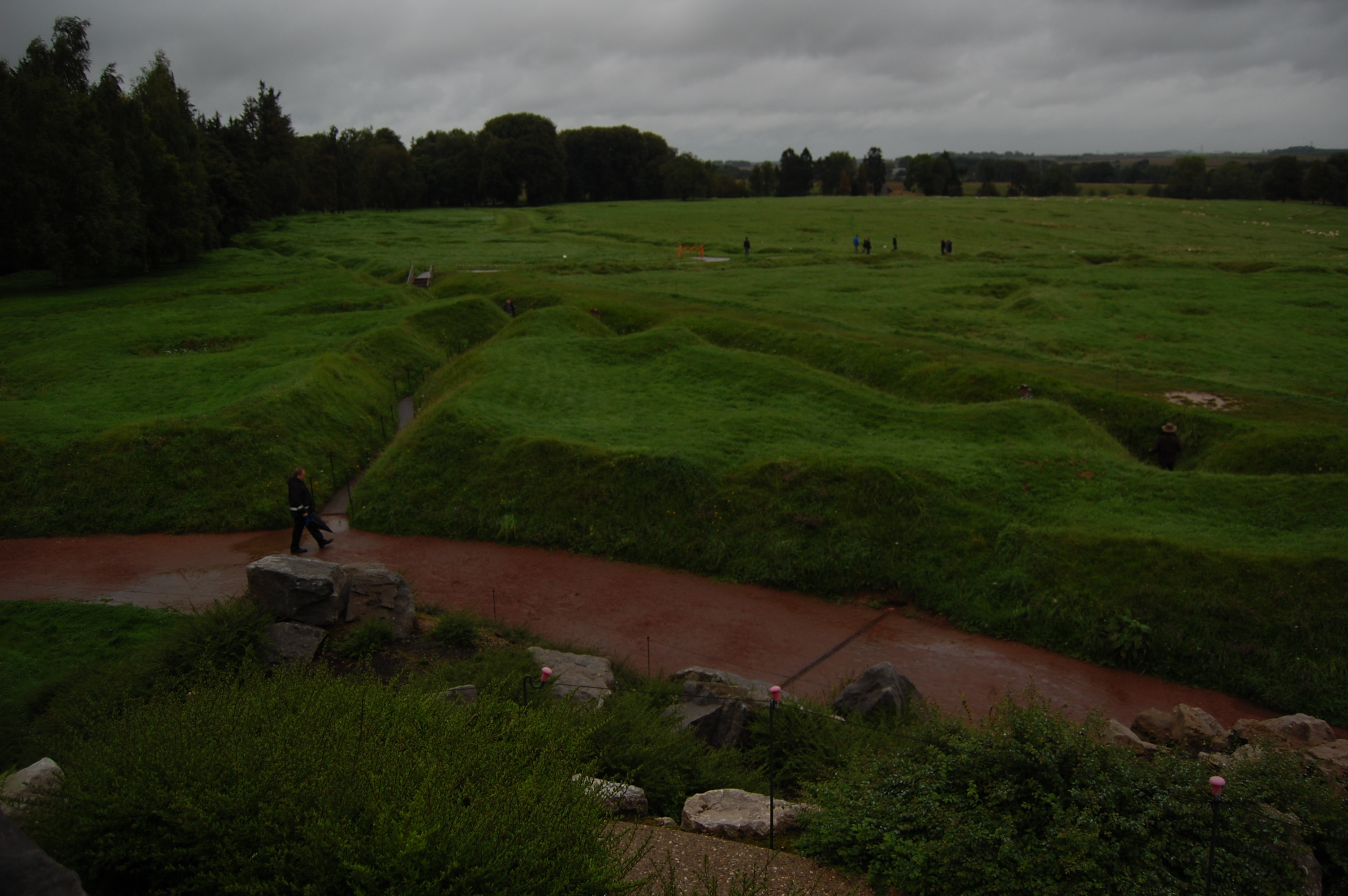
on 28th September 1916 when the 51st Highland Division took the ridge. A most imposing monument that dominates the skyline. Picture 3 {0182} - A network of British and Newfoundland trenches can be seen heading out towards No Man's Land
and the German front line. It was from here on that fateful day, 1st July 1916 that British and Newfoundland troops advanced;
casualties were high. To the top left of this photo is Hawthorn Ridge where there is now a cemetery. This is where the famous
Hawthorn Ridge mine was exploded on 1st July 1916 to signify the start of the Battle of the Somme. Picture
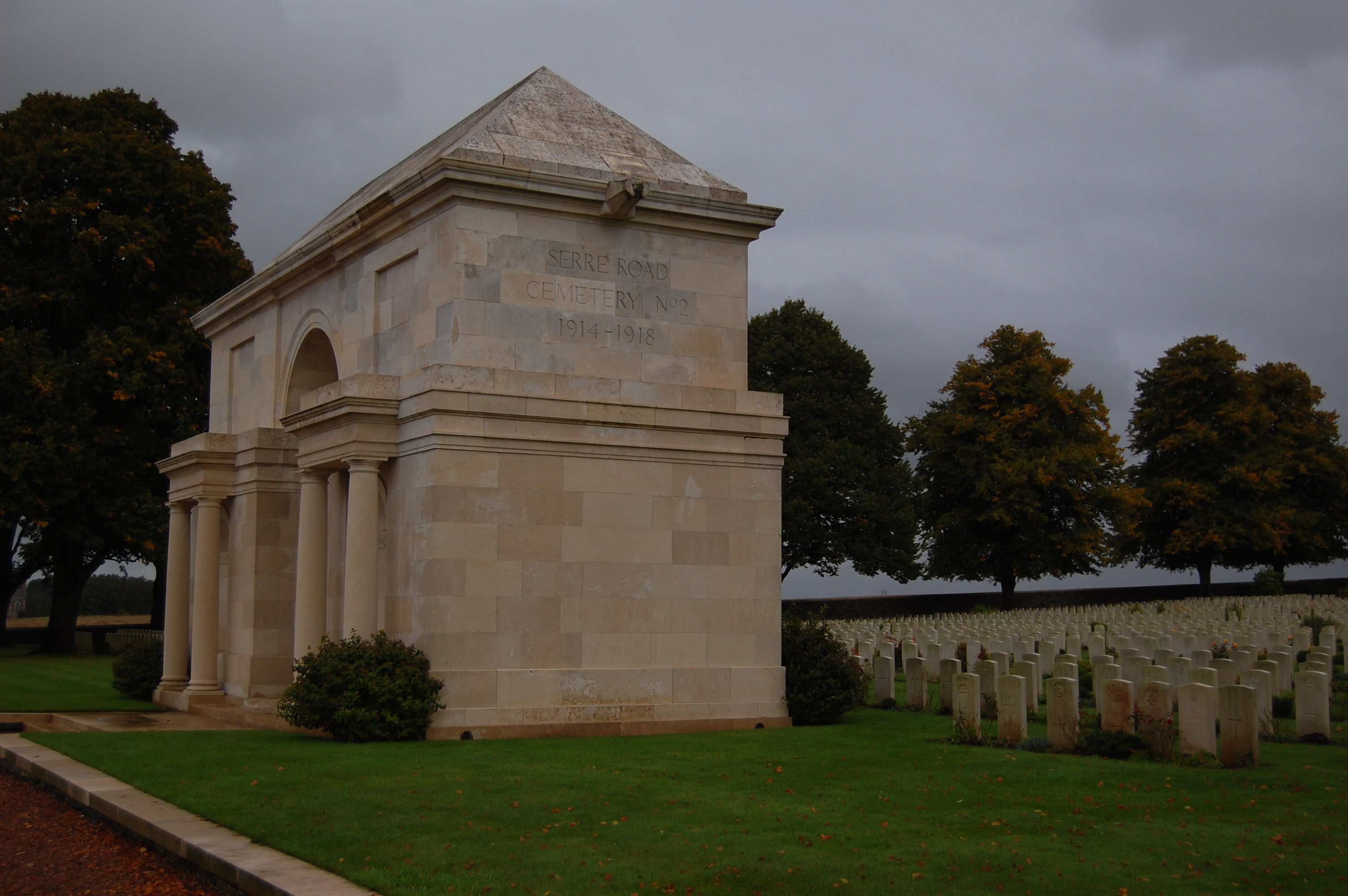
4 {0195} - Serre Road Cemetery No.2. 11km Northeast of Albert the cemetery contains 7,127 commonwealth burials mainly
dating from 1916 of which 4,944 are unidentified. The Cemetery was designed by Sir Edwin Lutyens. Picture
5 {0198} - Serre Road Cemetery No.1. 11km Northeast of Albert, 2,426 casualties are buried or commemorated in this cemetery
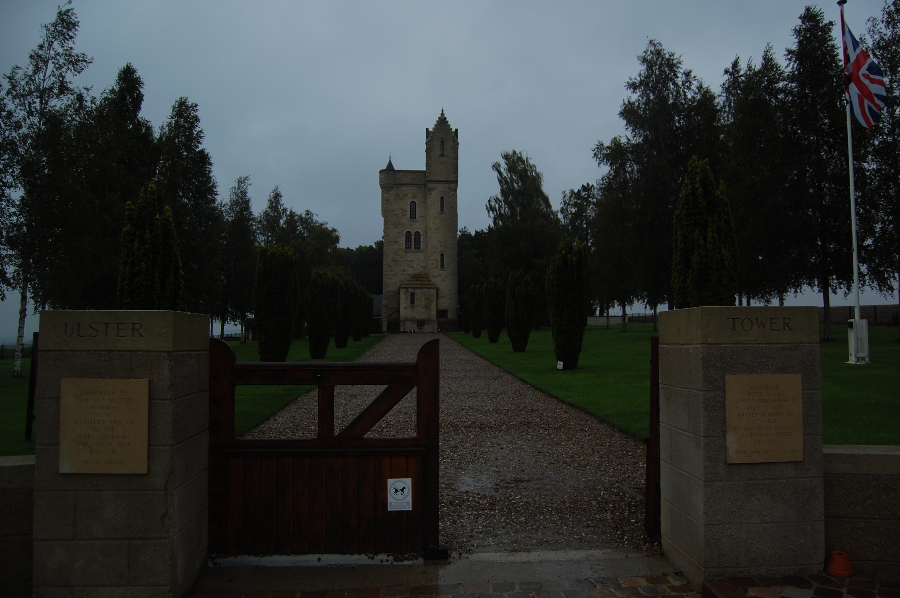
of which 1,728 of the graves are unidentified. Most of the graves date from 1916. The cemetery was designed by N A Rew. Picture 6 {0166} - Memorial to the 36th Ulster Division. Set now in a small park, this is the location where
the 36th won glory on 1st July1916. It is a copy of a memorial at Clandeboye, County Down, where the division were trained
before coming to France. Within there is a chapel, visitor room and an apartment normally occupied by CWGC officials. The
memorial was unveiled by the Duchess of Abercorn on Armistice Day 1921. In spring and autumn after ploughing, the surrounding
fields are criss-crossed with chalk slicks which follow the course of the German trenches. Picture 7 {0168}
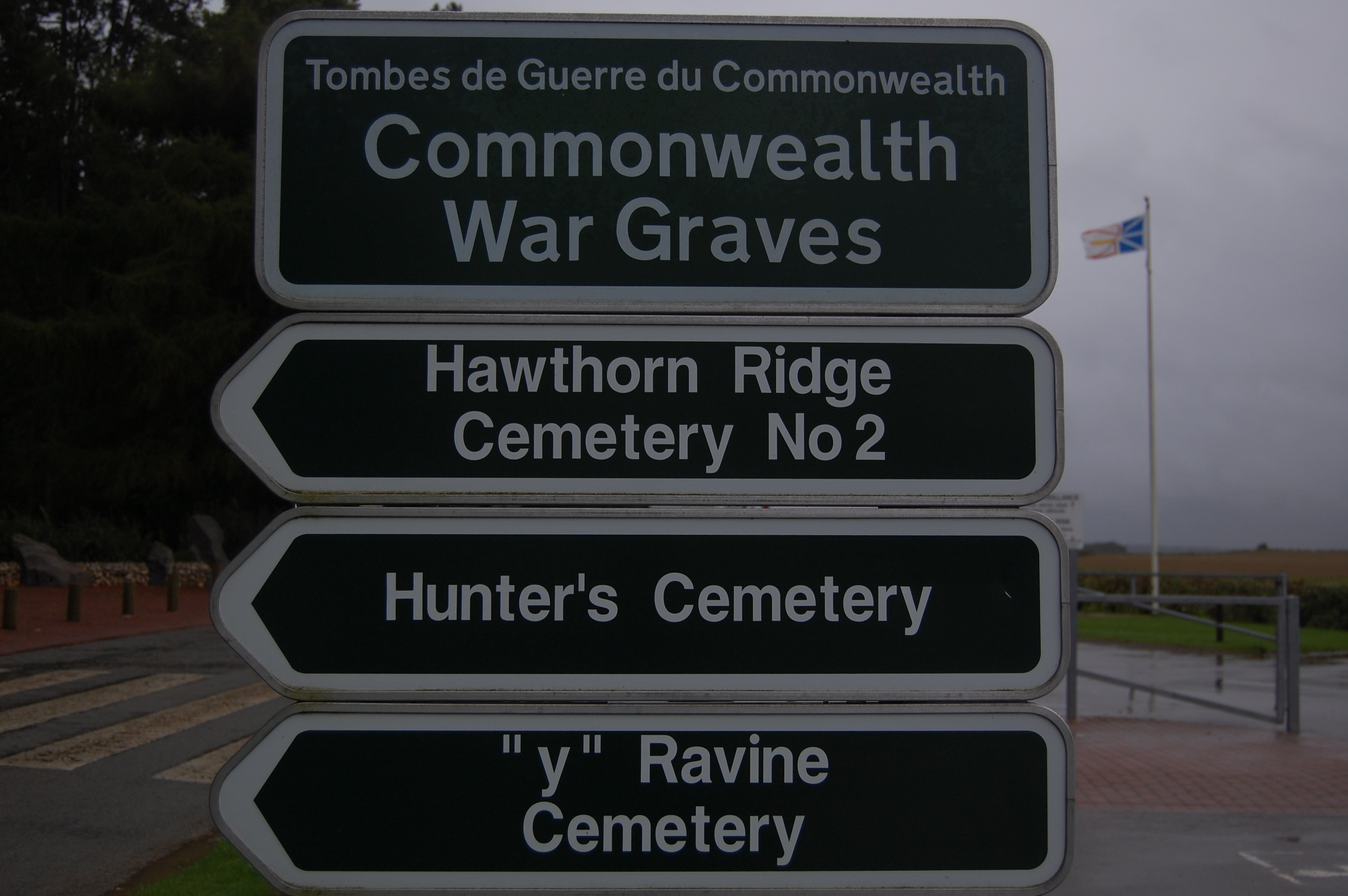
- Example CWGC signs indicating the way to the various cemeteries; these happen to be on the road outside Beaumont Hamel Newfoundland
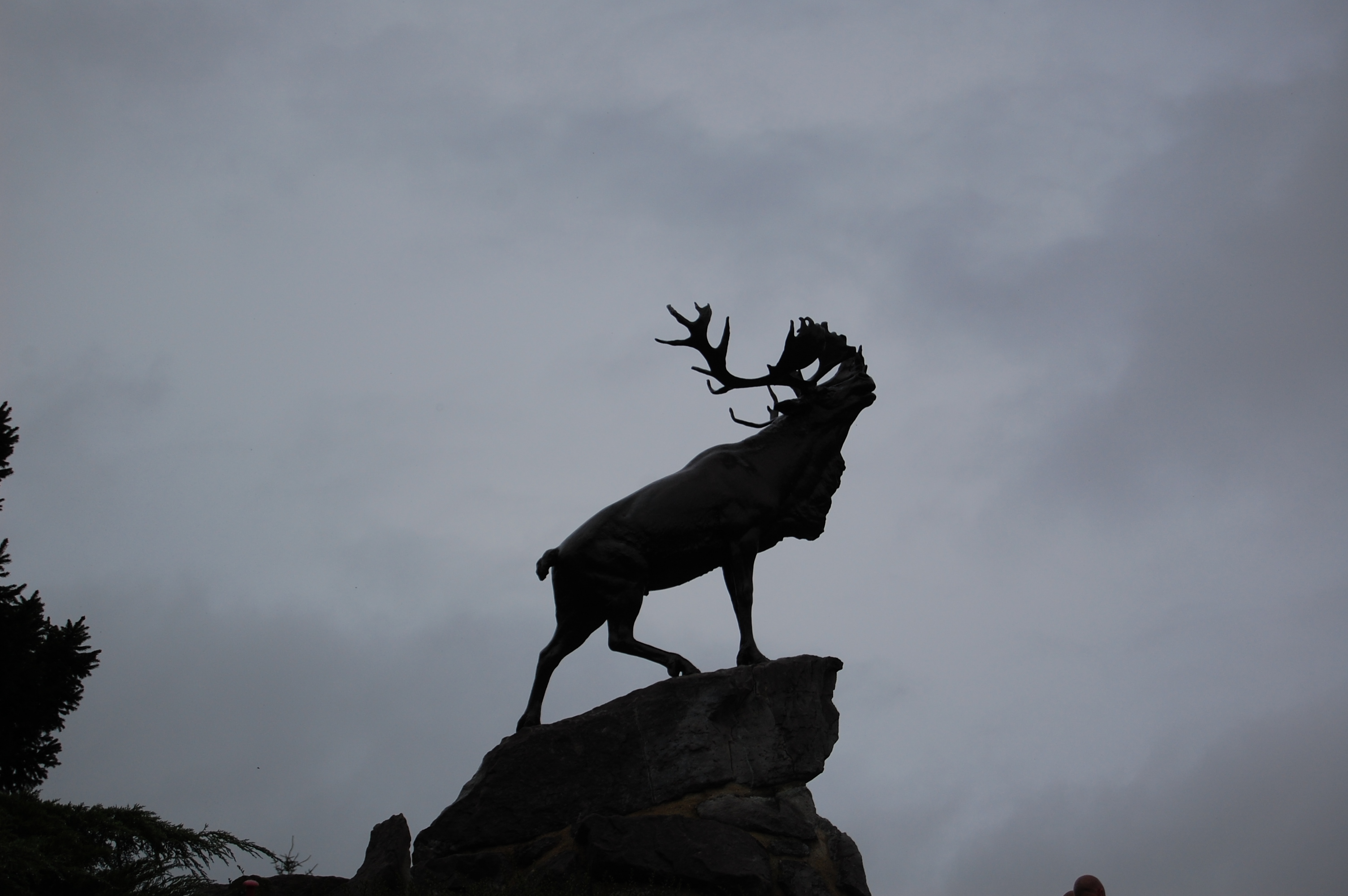
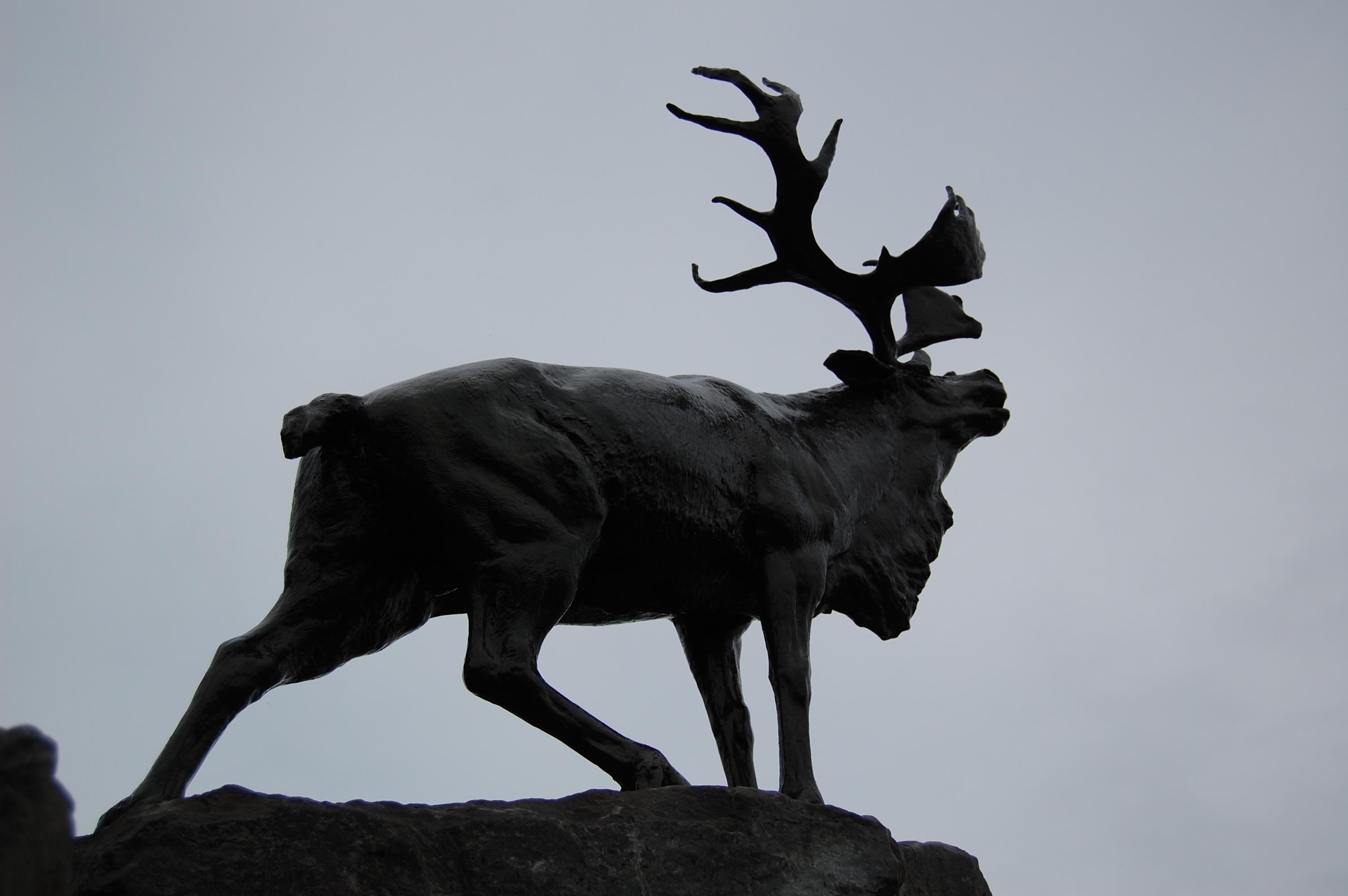
Memorial Park. Picture 8 {0175} - The Caribou is mounted on the Memorial to the Newfoundland Missing on land
and sea; it has the names of 800 men from this small country listed on the bronze panels below. This is located at Beaumont
Hamel Newfoundland Memorial Park. Picture 9 {0181} - The Caribou at Beaumont Hamel Newfoundland Memorial Park.
From the viewing platform of this memorial you see before you a real-life full-scale trench map. The site is cared for by
Veterans Affairs Canada, a Canadian Government organisation. This Caribou is the largest of five Caribou Monuments in France
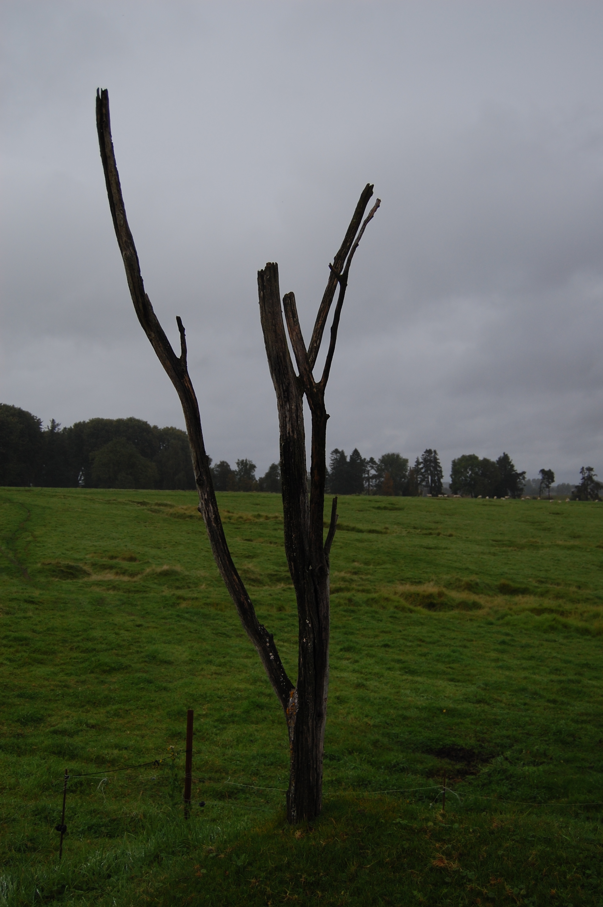
and Belgium. The area stretching out in front of the monument is the largest preserved area of the Somme battlefield. Picture 10 {0189} - This is a true relic from 1916, the petrified Danger Tree in No Man's Land. Y Ravine Cemetery
stands to the right of the photo; the ravine was a German position. Standing in No Man's Land taking this photograph is
a strange feeling and the position certainly makes you realise how near the two opposing front lines were to each other. These images are kindly provided by Ian Humphreys, RBL, and are his Copyright. You may click on the thumb nail images
for the original - these are high res images and may not be used for commercial purposes without full written consent from
Mr Humphreys. Each image is 3264 x 2448 pixels or 3008 x 2000 pixels and are several MB in size..
|
||||||||||


AREA17: So that we may all remember those that served, those injured and those that fell for the peace
and security of all...


Please support The Royal British Legion, ARMY-ABF, NAVY & RM, RAF-BF, SSAFA, The Felix Fund and Help for Heroes charities.
ADM Shine
Technologies Ltd Main Telephone number is: 02476 102901 or look at the Contact Us page.
|
Site Visits Counter: |
|
Page Counter Reset Date: 02 Sept 2017 Reset Total Site Visits: 048,328. Since new website launch in June 2013, excluding compliant bots, the Real Server Page hits are 568,384 and Non-Page hits are a further 299,286. Which is a 24/7 hit average of 22.6 hits/hr {15.3 Pages & 7.3 Non-Pages per hour}.
We do not use Cookies on this site. We do however use Server Logs via a utility called
Matrix Stats to understand usage of this site and in no way does that capture user information that would affect your privacy
in accordance with The Privacy and Electronic Communications (EC Directive) (Amendment) Regulations 2011. The Site Visits
Counter is merely a page hit counter and the Reset Total Site Visits is a running total of that Site Visits Counter at the
time of last reset. Tracking of unique users is not done on or with this site. The Site Visit counter is a simple scripted
four digit counter and the Reset Total Site Visits is a running total of all page hits since launch of this website. The Matrix
Stats view is the real hit rate for the site as some client browsers will not increment the page hit counter.
Copyright (c) ADM Shine Technologies Ltd 2022